Thursday, May 31, 2012

KY to IL to KY again


 Today we drove over the Ohio River into Illinois from Kentucky.

 In Golchonda, IL we saw murals in the city and learned the Cherokee Trail of Tears came through on their walk to Oklahoma.


  Rock-in-Cave, IL is an old pirates' cave (now in a State Park) on the banks of the Ohio River.


 We watched cliff swallows above the cave entrance, tending their nests.

  We took a small car ferry across the Ohio River back into Kentucky --


  and drove back roads through farms and acres of wheat fields.


Beautiful Big Spring, Missouri


 Big Spring National Scenic Riverway in Missouri was a side trip we almost didn't make.  When we pulled into the park we decided to eat lunch at the lodge.


 We learned the park had cabins for rent and decided to spend two nights.

  The next morning we got up early and explored the fresh water spring, one of the largest in the US.  286 million gallons of water *A DAY* flows from the limestone rocks!

 
 We followed a path and climbed limestone steps and rocks through the thick forest.


 A pretty Red Admiral butterfly kept landing on my big toe.


 Looking down from a bridge into the crystal clear water . . .

  .. . and a view into the woods from the same bridge.

   The second morning when we had to pack up to leave, a storm rolled in.  Thunder and lightening and then heavy rain soaked the forest around our screened in porch.


Sunday, May 27, 2012

Bentonville, Eureka Springs & Hot Springs, Arkansas

  We didn't plan to drive into Arkansas but we heard about some interesting cities and routes "you must drive" (hiway #7).

   In Bentonville we visited the Museum of Native American History --


   And on Main Street (Bentonville) we saw the first Five & Dime store (Ben Franklin) that Sam Walton managed.  The store is now a Visitor's Center/museum for the history of Wal Mart.


 We watched several short movies and read timelines that continued from one room to the next.  Sam's pickup is on display, complete with keys and registration papers in a plastic display box.

  There was even a display of items returned - one, this thermometer that the customer said didn't keep good time.


   Eureka Springs in the beautiful Ozark Mountains is a hilly town with narrow streets and old buildings that are now arts and crafts shops.


We toured the preserved Fordyce Bath House (above) in Hot Springs National Park, learning the strange cures (mercury, etc.) that were practiced 100 years ago.


  Leaving Hot Springs, Arkansas, we rode the elevator to the top of Mountain Tower for a 140 mile view of Hot Springs, the beautiful Ouachita Mountains and the surrounding Diamond Lakes area.


Easy Repair near Jasper, Arkansas

  On the driving days we feel like it, we have a photo contest.  We agree on a subject and find simple prizes to buy.   It's a little tricky when the only two contestants are the only two voting - but it works out . . .


  I won the subject:  "Red and Wild" yesterday with this road sign --


  -- and won again today:   "Unusual Signs".


  The owner jogged across the hiway calling, "Can I help you?" when he saw me taking photos.  He asked why and I explained, "I think I just won a photo contest with your great sign!"

   He immediately started asking me questions - "Were you able to read the letters from the road?"   He explained how he found the motorcycle part ("Kawasaki" he added) in a ditch a few dozen yards away and got inspired . . .  that another guy who has a much bigger sign "down the way" is getting all the motorcycle repair business though.

   So we discussed my suggestion of a large wooden sign propped against the base, facing traffic.  He was jazzed, he did lots of size measurements with his hands.

   We heartily shook hands as we said g'bye.  I asked, he answered -- "They call me 'Easy' in these parts".   "Nice meeting you and good luck", I replied.


Tuesday, May 22, 2012

Rutting in Kansas (by Brock)


Kansasans claim a strong historical connection with ruts. It's hard to find a map or tourist guide to Kansas that doesn't list the ruts of Kansas as significant and important cultural attractions to be sought out and appreciated by those visiting the state. Whereas in Montana it's common to be asked “Got yur Elk yet?”, in Kansas we were often asked “Seen a rut”?

Apparently ruts are distinguished from ditches in that ruts are normally found in pairs and run in parallel. While this can be confusing to neophyte rut hunters (i.e., rutters), with patience and experience, the confusion lessens and the two are rarely mistaken for one another except during heavy rains.

The story goes that the Santa Fe and Cimarron Trails were forged by settlers moving West in their prairie schooners – known to rut cognoscenti as “rut wagons”. [Note: earlier interpretations of the meaning of the term “rut wagons” have generally been discredited as the prurient fantasies of virgin historians.] As the wagons crossed the Kansas prairie, their heavy iron-clad wheels dug deep ruts that can still be seen today as this photo clearly shows:


We, as rookie rutters, did find rutting wasn't as easy as we first believed. It requires the development of a keen eye and an advanced skill set far greater than that needed by those (called “trunkers” or “stumpers”) who seek out the trunks and stumps of Kansas as documented by Nola (see below).

Regretfully we are soon leaving Kansas as we head East – but be assured we will continue our rut quest – seeking those enduring symbols of Manifest Destiny and the settlement of the American West.


Stumps and Trunks of Council Grove, KS

   Town after town, mile after mile as we drove the Santa Fe Trail route through Kansas, we searched for interesting bits of history to explore.

   We had little luck until we drove into a small, tree lined rural town called Council Grove.  The grand oaks were pretty and we were soon to discover just how protected and honored their ancestors are.  I saw no human statues anywhere, but oak stumps and trunks were well marked, in guide books and on foldout city maps . . .  located on the main road for everyone to read about and enjoy.


First we found the dead trunk of the Post Office Oak.  It died in 1990 but has been lovingly preserved in front of a closed down brewery building.  The wooden umbrella installed above provides wonderful shade from the hot sun if one wants to examine the dried decayed bark.


 A brief walk down the same street brings one to the Council Oak stump (below).  The splintered and dried stump is barely held together with rusty metal cables - shaded with a cool orange awning and fence protected, perhaps from dogs too . . .


And across the street and in front of Ray's Apple Market - another famous stump (with sprout date and lots of decay) but not fenced or shaded though.  (below)


As I drove the long thin, rolling roads through the Kansas wheat fields - leaving Council Grove I reflected on all the stumps and trunks history I never knew --


Monday, May 21, 2012

Soldiers, Grain and Burgers Across Kansas

 We're following the Santa Fe Trail across Kansas.

There are historic sites with tin soldiers.


 But mostly we're seeing lots of grain silos with ammonia tanks on wheels parked nearby --


 -- and bored, sad cow faces in gigantic feedlots.


New Mexico to Kansas

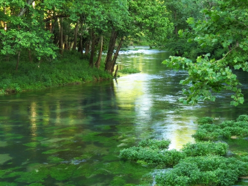
 There is something totally magical about the light in Northern New Mexico.  I'm going to miss the beautiful shadows, old wood and the feeling of the West all around.

 Cimarron NM:   'Valerie in the Gallery'  loved to tell her story of a 20 year collection of Boy Scout troop badges.
Annually Boy Scouts arrive from all over the US to visit the Philmont Scout Ranch and add to her badge collection that extends the entire length of her art gallery above the counter wall.


Cimarron's bookstore is brightly painted like a shelf in your den.


Passing by Raton, NM we stopped at the 33,000 acre (52 sq mile) NRA Center.  The Welcome Center has a large museum of historic firearms, history - also a gun and gift shop.


Capulin Volcano in northeastern NM is a 1,300 ft cinder cone last active about 60,000 years ago.  
 The mile hike around the top rim at 8,000 ft. is an amazing bird's eye view/360 degrees of the plains below.   The hike starts at the parking lot in the middle of this photo.


 As the parking lot nearly disappeared from view (lower right), we continued our hike.


The wind started blowing hard and a dark storm to the west seemed to be moving towards us.  We finished our hike and drove east into Okalahoma (briefly), then into Kansas to spend the night in Elkhart.